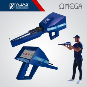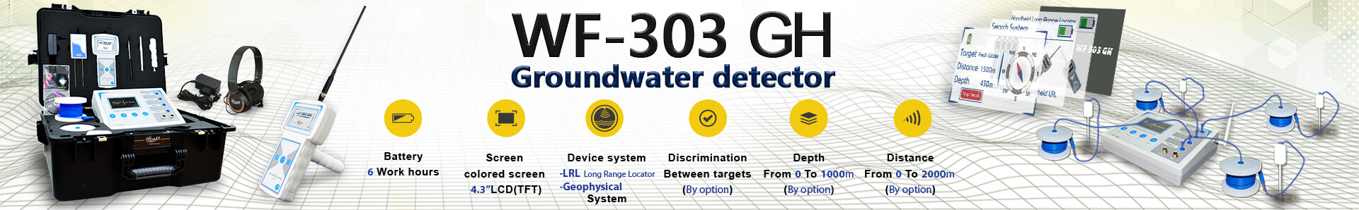


WF 303 GH
5,173$
Well drilling problems are over with this machine. WF-303 GH The latest in the world, Misses a lot of farmers and water prospectors for a sophisticated device that reducing the trouble of fatigue and random digging, and gives them accurate and certain results about the groundwater for digging wells.
Country of Origin:
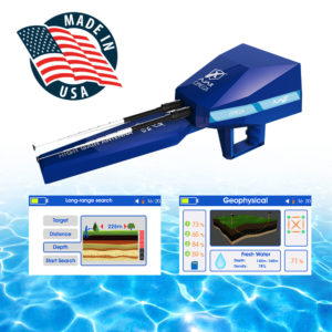
USAMaximum depth:
800 مLong distance:
2000 مTargets:
Water under groundDevice systems:
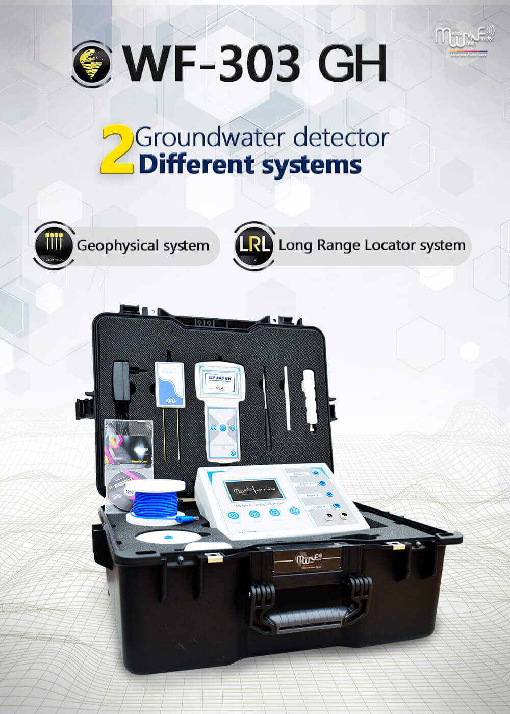
Long Range Locator and Geophysical system
- Bank transfer
- Credit card
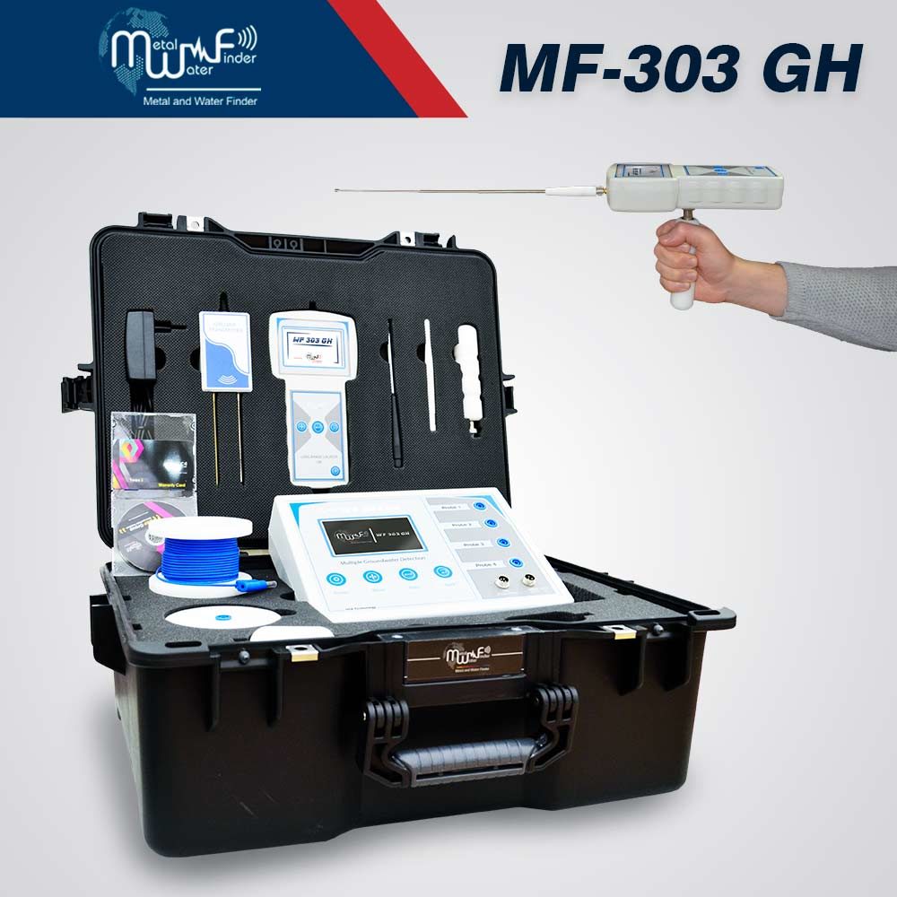
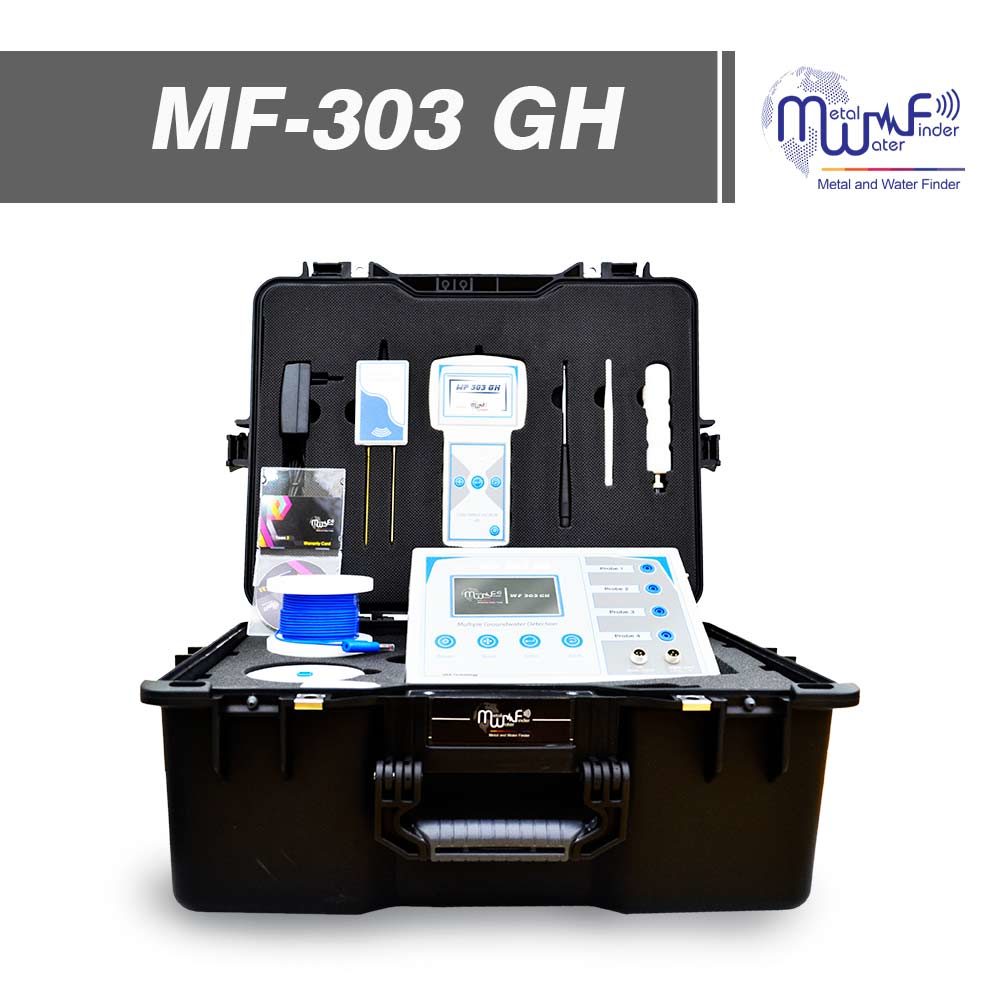
- DEVICE INFORMATION
- FEATURES
- Detection systems
- Accessories
Well drilling problems are over with this machine.
WF-303 GH” The latest in the world,
Misses a lot of farmers and water prospectors for a sophisticated device that reducing the trouble of fatigue and random digging, and gives them accurate and certain results about the groundwater for digging wells,
Therefore, the MWF Group has carried out more than 7 years of research and development studies and research, Producing an advanced WF 303 GH device with unparalleled specifications, specializing in the detection and exploration of groundwater up to a depth of 800 meters and covers a search distance of 2 km,
Determines the salinity and type of water and the analysis of ground layers to verify the existent of metallic rocks, granite and cavities as well that may hinder the drilling process.
Through using this device, you will get a detailed report on water and soil as well to avoid obstacles and errors of drilling, this device is equipped with two integrated systems to search for groundwater, the geophysical survey system, and Handheld LRL system.
• Great speed in presenting the results to the user, with integrated and comprehensive data about the water point, density, depth and type, with full report about the type of soil as well.
• Unparalleled high precision in water identification and detection and to ensure its existence by 100%, an error rate of 0%.
• Works on an advanced and integrated electronic system that shows all search data and results directly on the device screen.
• It can determine the largest point of water where is can accumulate, That is, the water may be existent at several points, but the device determines the main and most dense downstream, Which ensures to the user continuity of the water production of the well for a long time.
• New and advanced functions enable the user to complete the search process with ease and without any complications.
• Help messages and automatic instructions that appear to the user on the screen to help him use the device and complete the search process easily.
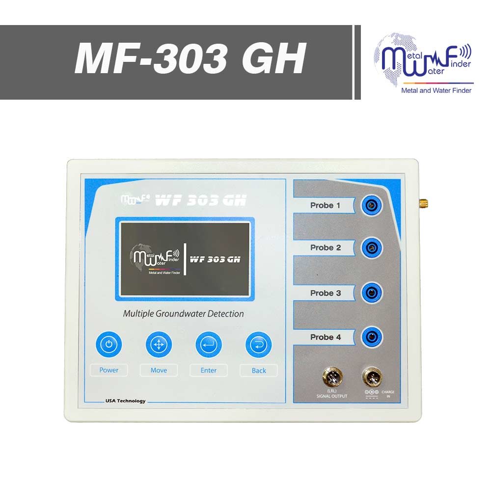
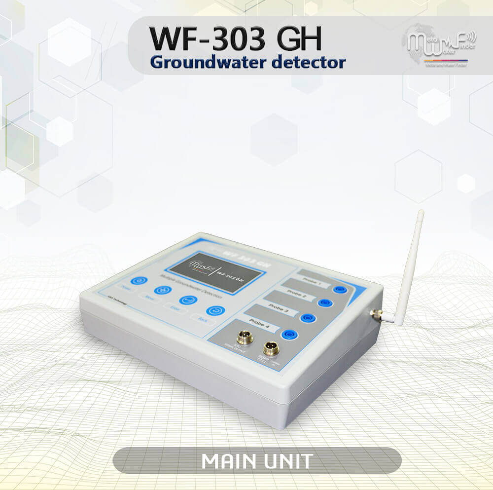
• The 4.3-inch TFT color display with high definition accuracy, gives the user a clear vision.
• Device’s general settings menu that gives you control of the following:
– Screen Brightness Control: Gives you comfortable and convenient lighting with 10 different levels of brightness.
– Volume control: gives you precise and convenient volume control, with 5 different volume levels or silent mode as well.
– Language Control: Multilingual and gives you control over changing the language of your previously saved device to another language.
• The systems interface allows the user to choose the detection system that they would like to work with, and to complete the search settings with ease and flexibility.
• Signal filtering systems, to avoid any interference from any radio or frequency waves existing in the air or in the soil.
• Automatic Tuning System (ATS) Special invention and new, registered in favor of MWF GROUP, this system provides accurate results and proven in all types of soils and terrain, because the system recognizes the soil automatically, grants the search process automatic tuning commensurate with the type of soil and properties of soil , With the abolition of any overlaps radiation resulting by the rocky and mountainous territory effect, which may affect a lot of other detectors, but the this smart system, can sorting and analysis and provide the necessary levels which relates of frequency signal, voltage and wavelength of the signal which gives results free of any errors.
• Battery and charging smart feature, which gives the user accurate tracking of battery level and notices about battery level and alerts before the entry into force of power, with smart charging systems that give the user also follow up the battery charge when the device ON or OFF, and to find out the level of charging which added, all in real time.
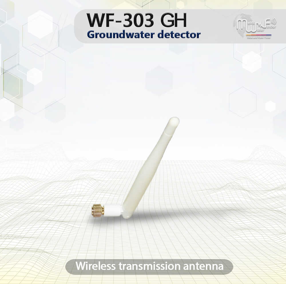
• Wireless connection system, smart wireless communication with the accompanying search systems.
• High quality and accurately performance, manufacturing this product by best elastomers, electronic components and circuits with international standards.
• Easy to work and to use anyone can use it.
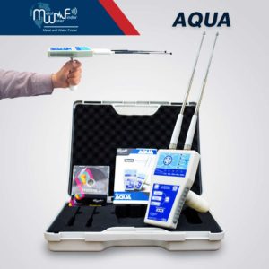
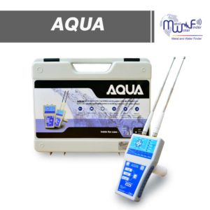
• Lightweight and easy to move around, all components of the machine are collected in a strong shockproof plastic case.
• The control panel is flexible with pressure buttons, and the control panel consists of the following:
– POWER Button
– MOVE Button
– ENTER Button
– Back Button
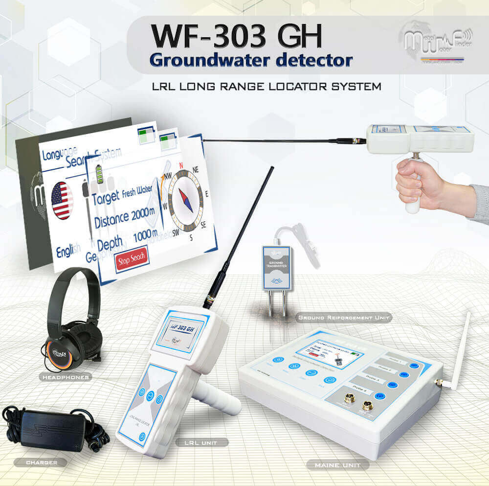
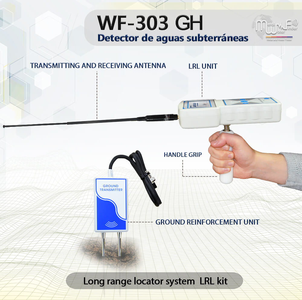
Handheld LRL system
The advanced and all-new long-range search system with high sensitivity and advanced features, Automated tracking system for accurate tracking of the water point path, audio results and digital indicators on the screen, determines the point of drilling for water with precision, with full control of search properties and criteria, the depth of search up to 800 meters, and covers a forward search distance of 2 km with accurate control of search coordinates.
• The user can be work on this system through a separate unit, take the search commands and settings by wireless from the main unit or even work on them separately and complete the settings directly from the unit, this system allowing the user to track the water direction accurately to determine the drilling point of water.
• Integrated data provided by this system, audio data, smart water location tracking system, track correction feature to track the water location to avoid drilling errors.
• The user can set the search criteria in advance according to the search requirements:
– The user can choose the type of water to be detected in advance: Natural fresh water – Mineral water – Salty water – and all types of water.
– Can be set the search distance level in advance: 100m – 250m – 500m – 750m – 1000m – 1500m – 2000m.
– Can be set the search depth level in advance: 50m – 100m – 250m – 450m – 600m – 800m.
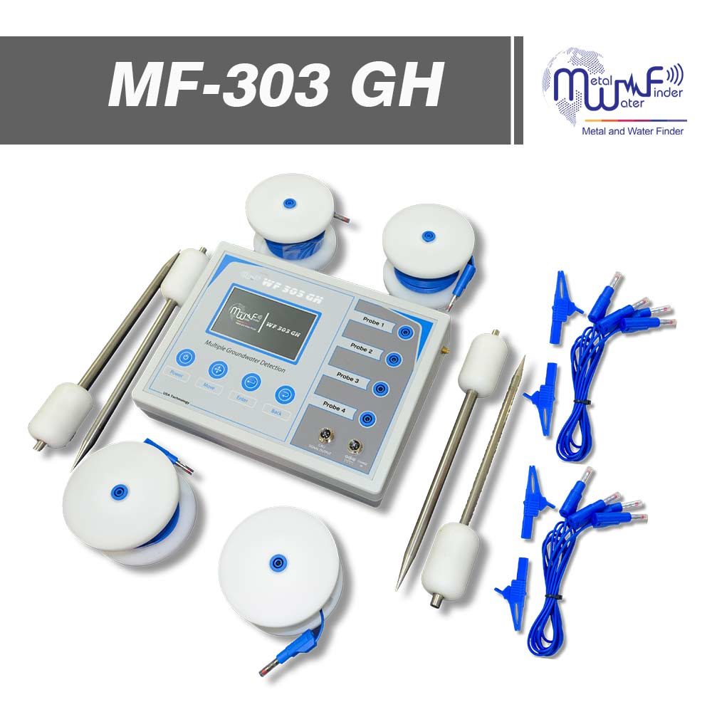
Geophysical Search System
Geophysical System with (VES) technology, which has unprecedented features for automatic detection of water quality and density, determination of drilling point, depth measurement automatically, and determination of soil type as well.
• Advanced algorithms and software to detecting and analyzing the ground to detect groundwater and to determine its locations and proportions.
• This system scans the entire research area at breakneck speed and provides a detailed report about groundwater the presence points and values.
• The depths up to 800 m, with automatic measurement of the level of water depth.
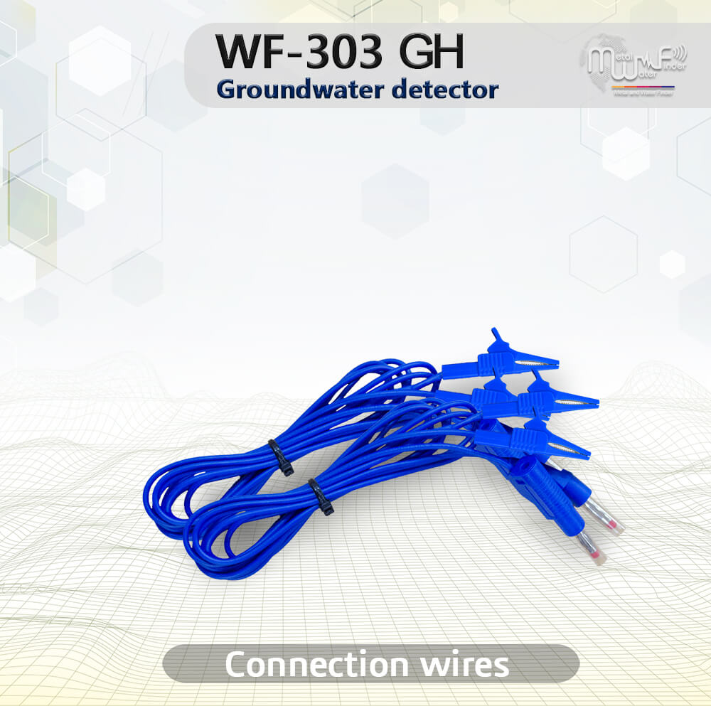
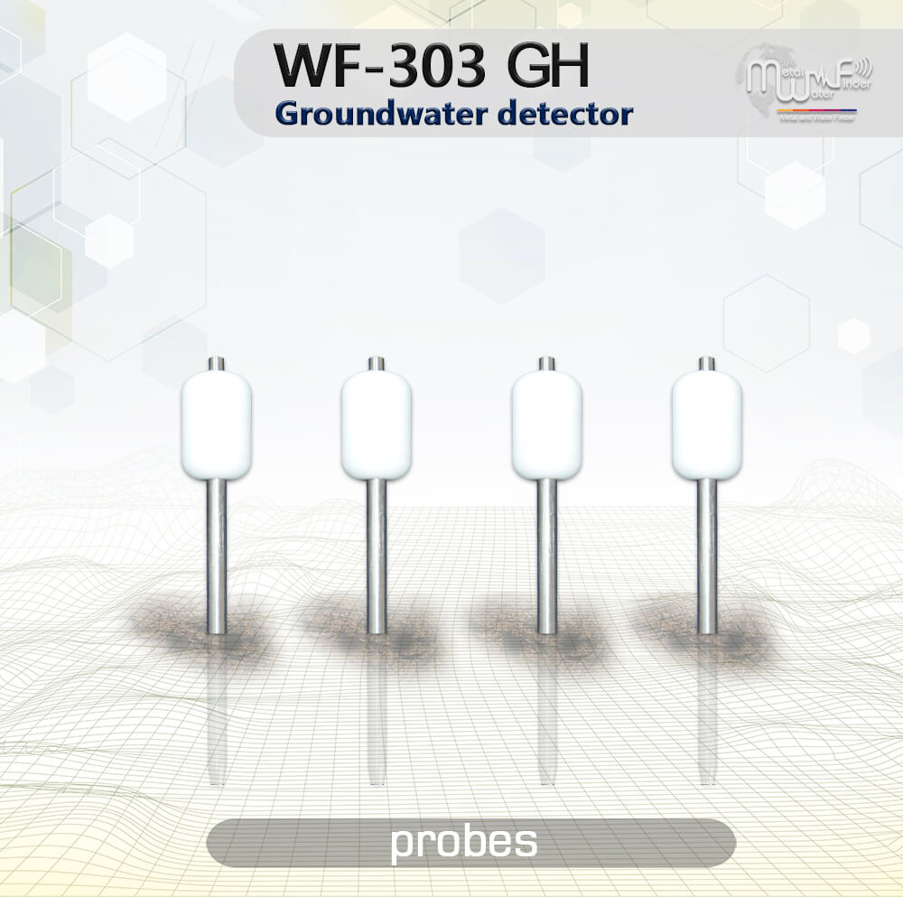
• Provided with 4 Cord reel cable with 4 electro-rods (Probes), covering an area of 1250 square meters.
• This system provides the user with a complete report after completing the scanning, according to the following:
– Water type: The water type is automatically detected if it is fresh water, salty water or mineral water.
– Water depth: The depth of the water is automatically detected and shows the level of water depth, for example between 420 meters and up to 520 meters.
– Water density: This result shows the density and quantity of water in percentages that inform the user about the abundance of water detected and the extent of continuity.
– Highest value: This result shows the highest value of groundwater flow between research electrodes.
– Cavities: This result shows whether there are cavities in the drilling area or not.
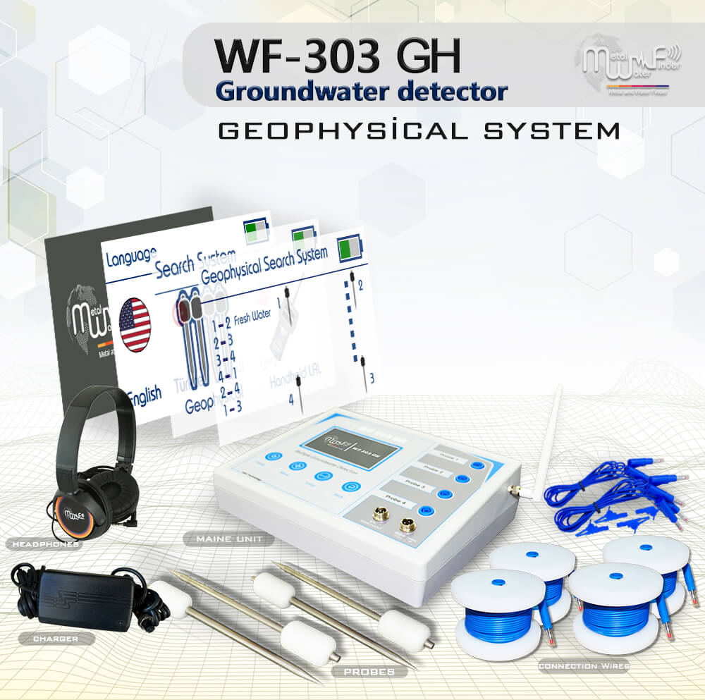
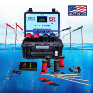
• The main unit of the device (the controller).
• 4 Electro-rods (Probes) to connecting electrical energy to the soil.
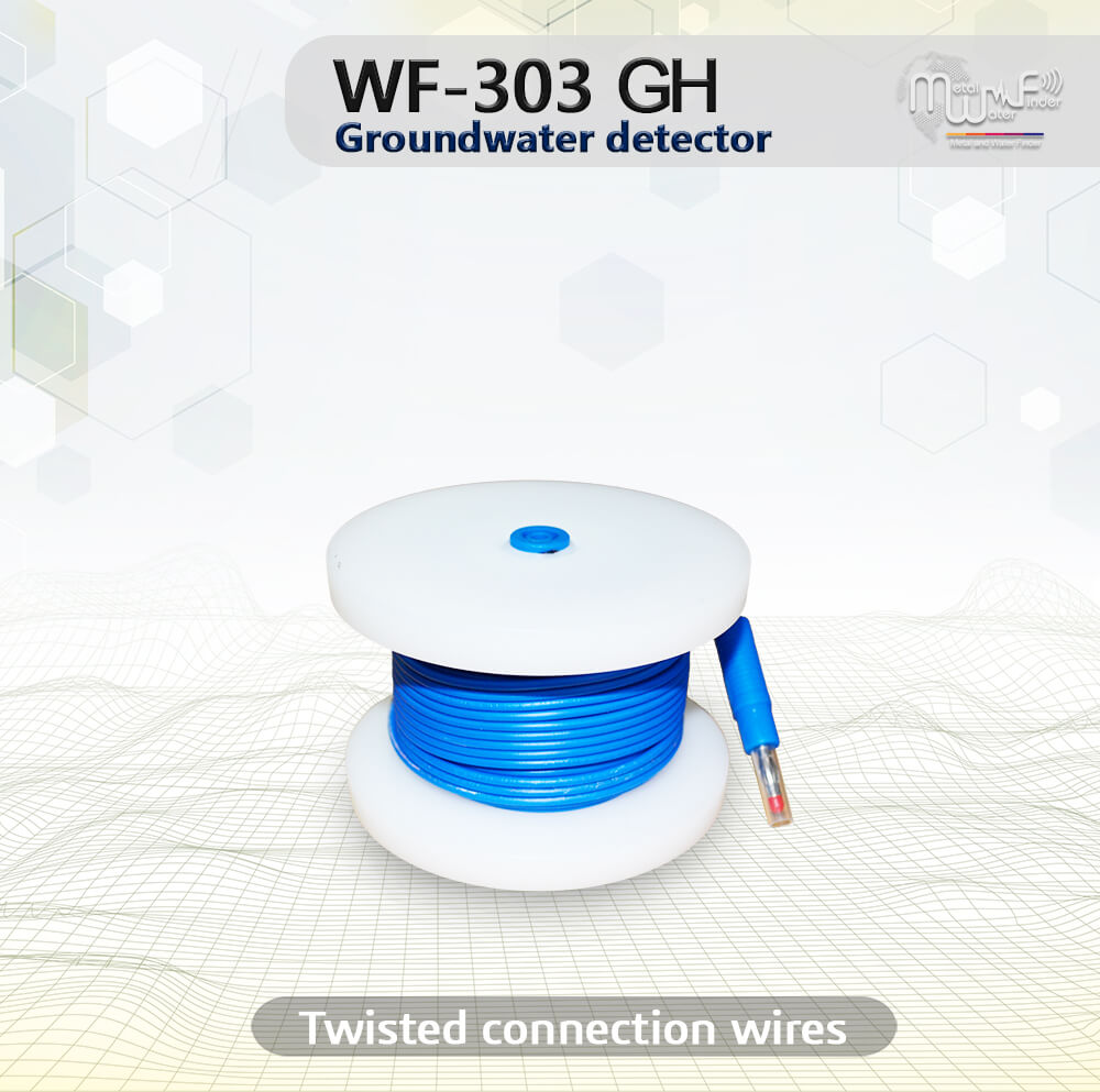
• 4 Dynamic cord reel cable.
• Connection wires for geophysical system
• Wireless connection antenna.
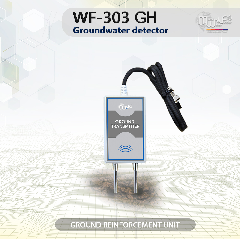
• Ground transmitter unite, For LRL system.
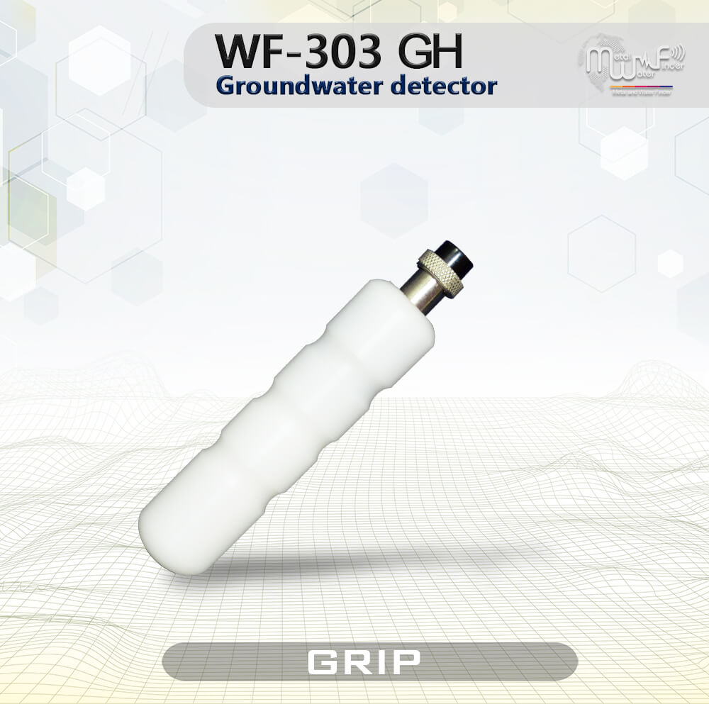
• Handheld LRL Units + Transceiver antenna + Grip.
• Device Plastic Case (Anti-shock)
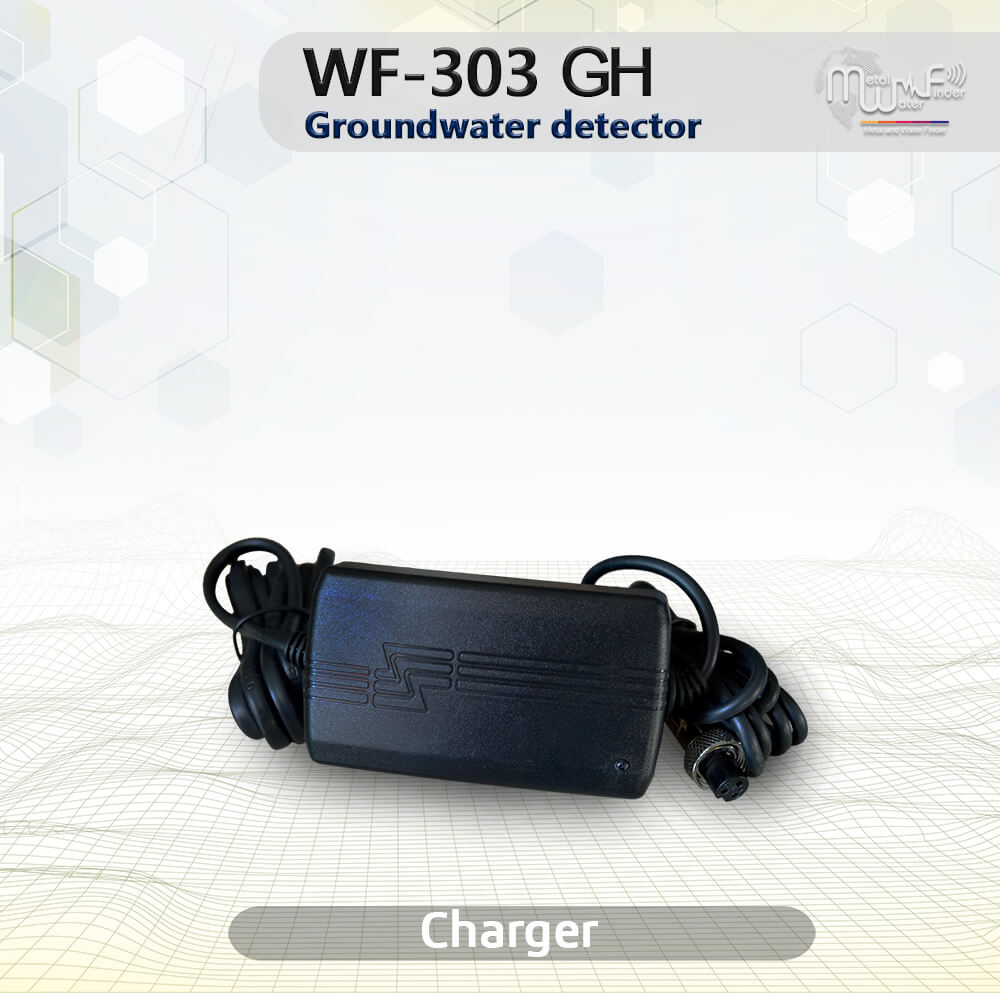
• Electric charger.
• 3-year warranty card.
• User’s Guide.
• Tutorial DVD.

Related Products
-
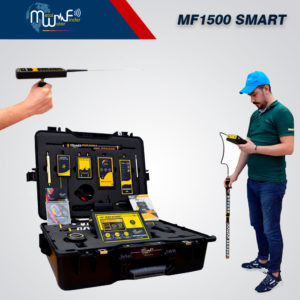
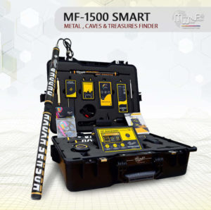
MF 1500 Smart
Manufacturer Depth Distance 40 m 2000 m Targets Water, Gold, Metal, diamonds and cavities
device systems 4 advanced detecting systems
-
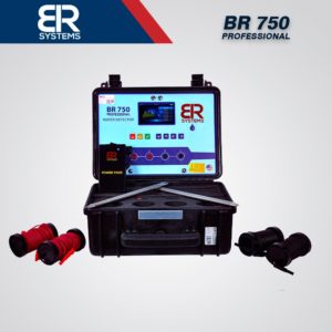
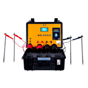
BR 750 professional
Manufacturer Depth Distance 1000 m -- Targets Underground water and artesian wells
device systems Geophysical Search System
-

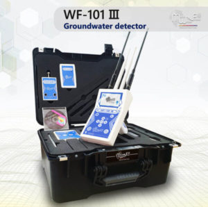
WF 101 III (Pro)
Manufacturer Depth Distance 800 m 2500 m Targets Water under ground
device systems Long Range Locator and Geophysical system
-
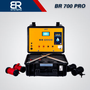
BR 700 Pro
Manufacturer Depth Distance 700 m -- Targets Underground water and artesian wells
device systems Geophysical search system